Southernmost point (not) - August 11, 2025
- Scott Farnsworth
- Aug 11, 2025
- 8 min read
Updated: Aug 18, 2025
SUMMARY We were signed up for an all-day trip south to the Cape of Good Hope. It included a 45-minute boat tour to seal island from Hout Bay and a drive along the coast which is supposed to be really beautiful. Unfortunately we were on the wrong side of the van to see the view although we had a really good view of the rocky wall beside us. We made several stops along the way including at the Cape of Good Hope and Cape Point. I was disappointed to find out that neither of these were the point at which the Indian and Atlantic Oceans met and in fact were quite far from it. Stopped in Simonstown for lunch and at Boulders Beach to see the penguins. Had a glass of wine at Time Out then a very good dinner at Black Sheep. - Karen
DETAIL We’ll be gone most of today on a tour. There’s a lot of confusion on where we’ll get picked up but finally it’s at our hotel close to 8 am. We pile into the bus and say Hi to our guide Sylvie, the other guests, and our driver. Sylvie is a hoot. She’s from Kenya or some such place and speaks with a heavy accent. It’ll be a long day. With everyone eventually picked up we’re like 18 people and Karen and I may be the only native English speakers. I can’t imagine that others understood much of what she said.
It’s 46 degrees when we wake, going to a high of 60. The big things for today’s tour are visiting the Cape of Good Hope and seeing local penguins. As we drive, Sylvie explains the ground rules. There’s lots of us and our day is packed, so people cannot be late getting back to the bus. One minute late is OK. Two minutes late and you must buy all on the bus hot chocolate. Three minutes and you must do the Macarena. She’s amusing.
We drive to the other side of the Cape Town peninsula, to Camps Bay. We hear how it came to be and the origin of its name. It’s safe here, so they have a very tiny police station and this is where mostly ministers live (politicians, I presume and not men of the cloth). Also there are a lot of foreign nationals with houses here. A quick stop for pictures and we’re on our way. One person is lost and thus late getting back to the bus. Good natured scolding ensues.
It’s a long drive down the coast to the Cape of Good Hope and so we hear a lot about the people and areas we’re driving through. We see both extremes: the wealthy with nice houses overlooking the water, and the poor squalid shacks of the townships. Many in the shantytowns emigrated from other poorer African countries and came to find a better life.
There’s more emigrants than opportunities, so there’s lots of extreme poverty. At an intersection we see dozens of people just standing by the side of the road or on the median. They want work, we’re told. People will just load them into their car, take them home, and get their house cleaned or some construction work done. The government tries to help, but it’s not easy.
We’re told that marijuana is legal here and that people grow it. We see cars at the side of the road displaying blankets, baskets and beaded animals for sale. There’s also a marijuana flag fluttering in the breeze next to the car. That signals that they’re selling weed if anyone’s interested. We also see the flag at people homes (shacks).
Sylvie asks if we know about the clicking sounds in many of the African languages. She gives us some words to try to say ourselves. It’s ridiculously hard. Some words are just clicking sounds strung together, and with other sounds being made at the same time. Not going to happen in this lifetime.
We pass one of the most exclusive ocean side cities. There’s one road in and out. Crime is low for that reason, no easy get-away route. People with homes here include Oprah, Madonna, Will Smith, the late Michael Jackson and others.
We get to a dock and get on a boat to go out to see Seal Rock. The boat has our group but also fifty or sixty other people. We all jockey for position, for a place to sit with a view. There are lots of bad choices for places to sit, but we get lucky and are up high. We’re protected from the wind, and have a view. There are thousands of seals on the rocks, all sunning and most sleeping. It’s winter so many seals are away now. In summer there might be 5,000 seals in the area, we’re told.
From the boat we can see a very long road snaking along the mountain on the other side of the bay. Soon we’re back in the van driving that road. It was built by prison labor (slave labor) and thus wasn’t of the best quality. After a land slide it was closed from 1990 to 2005 to be improved. Now there are huge metal nets, one behind the other, to catch rocks that fall. It’s windy and beautiful, with great views. It’s a toll road so it’s easy to shut down, which they do for filming James Bond films and BMW commercials.
Driving down the coast the road gets worse. Sylvie says it’s called an African massage. We see llama, alpaca, ostrich, horses and other animals. It’s scrub grassland, and beautiful. We can see the ocean for much of the drive. We learn that the original name for The Cape of Good Hope was The Cape of Storms. Later the king (Ferdinand of Columbus fame) was coming over for a visit. He wanted to encourage migration to this place, so he came up with the new name.
In Patagonia, at the southern end of South America it was the same story. The locals all used peat fires to keep themselves warm, and they were everywhere and it was very smokey. As such, the ‘discoverers’ called it The Land of Smoke. The king didn’t like the ring of that and so renamed it Tiera del Fuego. The Land of Fire.
Earlier this year, we were in Australia, and visited the Aussie island (Hobart) beneath the big island. We got down to the southernmost tip. Many years ago, when I visited Patagonia, we got to Ushuaia, the southernmost tip of South America. As such, I was excited to be coming to the Cape of Good Hope at the southern tip of Africa. Sylvie burst my bubble, though, when she announced that this is NOT the southernmost tip (that’s 240 KM east). We’re not sufficiently south by a mere 25 or 50 miles. Grrr.
The tip itself is nothing special. There’s a sign and everyone gets their picture taken. Nearby it’s just coastline, though the water is a little rough. We walk up to a light house, way up high. Too high. It spent a lot of its time in the clouds and because of that the Lusitania (may have misheard) missed the lighthouse and hit rocks and sank. 100s dead, thirty or so rescued. Now there’s a new lighthouse, at a much lower elevation. The old one is now just called a ‘ghost lighthouse’.
A good lunch and then on to the penguins. You used to be able to walk on the beach and touch the birds. That ended badly for the birds so now we humans are kept on a raised walkway, a safe distance from the penguins. It seems like there are more humans than African penguins. They are all on the beach, mostly hunkered down for warmth, all facing the same way (to minimize the effects of the wind, I guess).
Karen sees four penguins emerge from the water and waddle up the beach. Halfway up, a wave comes behind them and knocks them all down. She can’t stop laughing. We don’t stay long and there are more humans coming all the time. There’s an admission fee and they must be raking in the money. There used to be a lot more penguins here and their current small numbers worries me. I hope they’re able to survive.
On the drive back to town we see an eland. It’s like halfway between a graceful impala and an enormous bull (cow). It’s looks like it was designed by committee.
We do a quick visit to the colorful Bo Kaap neighborhood. After slavery was over, with all its regulations, blacks could finally own their own homes. The locals celebrated, in part, by painting their houses these bright, fun colors and it stuck. They wanted happy colors after so many years without much happiness.
For dinner we finally get to Black Sheep. It’s two blocks from where we’re staying and it’s a favorite of both our host and our friends in Austin. It’s really good and when we come out we discover that at night they illuminate Table Mountain. It’s quite striking. We walk the two blocks home, in the dark. We’re not totally comfortable but all’s well that ends well, eh? Tomorrow we say “Bye” to Cape Town and head up into the wine country!
Photos
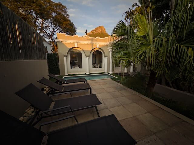
Waiting for our ride we look back at our Bed and Breakfast. There's the small pool we won't use, it being the middle of winter. Peeking out above the building is one of the many peaks that surround (and punctuate) Cape Town.
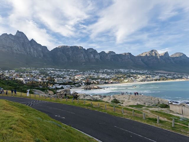
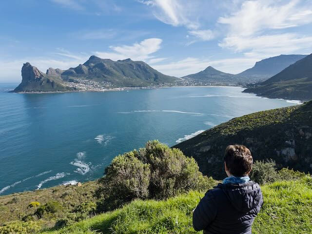
First Stop: A view of the Glen Beach and behind it the seventeen peaks that make up The Twelve Apostles. I guess they're not perfect in the math category.
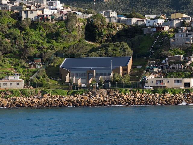
On our boat heading out to see Seal Rock I see this building with barbed wire fencing all around. A jail? Maybe, but then again most buildings here have some barbed wire protecting them.
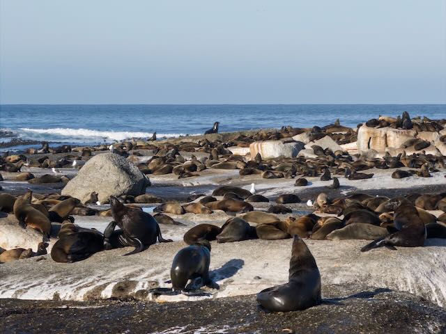
Seal Rock. So many seals! And this is only 20% of what it'd be like in a few months, come summer time.
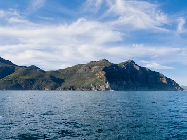
Across the way we see a thin line that is a road with cars on it. Little do we know, that's our next stop.
Looking back at where we got on the boat to motor over to Seal Rock. It's a pretty bay, but there's no end of natural beauty around here.

Driving along we get quick glimpses of the wire-mesh fences they put up during the 15 years this road was closed to make it safer. We see a strong fence, and behind it will be another and so on. It must be pretty dangerous. We also see workmen who are there daily double checking that there won't be a catastrophic rock slide.
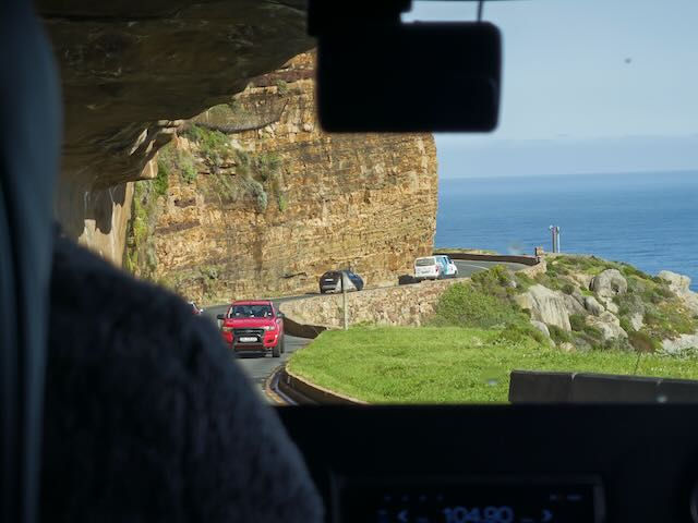
To road is pretty and windy. Periodically it's closed so they can film another James Bond film or an ad for BMW or Mercedes.

This is someone selling stuff to make some money. The flag on the left, with the marijuana leaf, communicates "I sell marijuana, if you want some".

Through the windshield we see the impressive waves crashing on the shore.

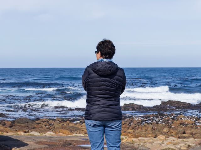
Finally down to the Cape of Good Hope (previously the Cape of Storms... probably more on the nose). We were thinking this was the "southernmost point" etc. but no such luck.
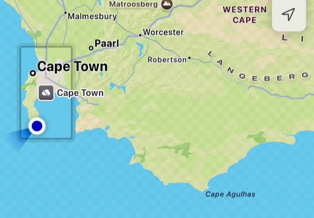
Apparently Cape Agulhas, 240 km to the east (and 25 or 50 km further south) is that darn "southernmost point". It's also where, really, the Indian and the Atlantic Oceans meet. Rook!
Without the signs the coast line doesn't look all that impressive.
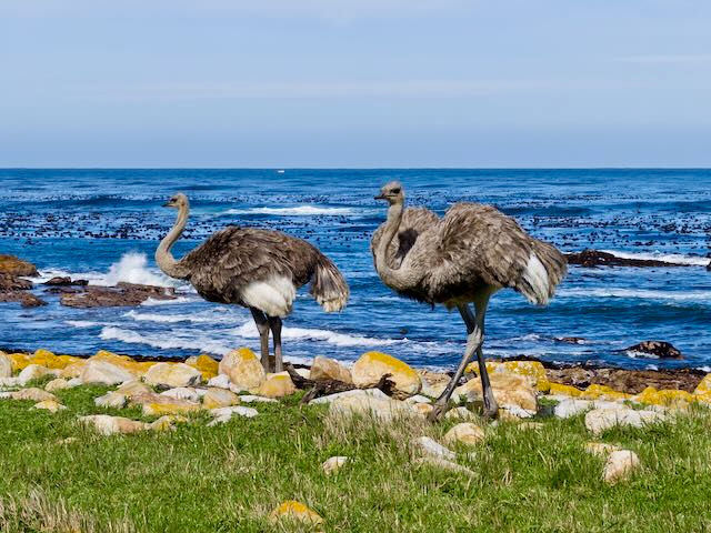
There's livestock roaming around grazing. Well, just a bunch of ostriches, really. Picturesque place to graze, eh?

We get to walk up to the "way too up high" lighthouse (barely visible towards the upper right). It was too high and spent lots of time "in the clouds" doing no good. The stetch here is also called "The Graveyard of Ships" due to all the wrecks. Now, there's a new lighthouse, much closer to sea level, that boats can actually see (called "The Beacon of Hope").
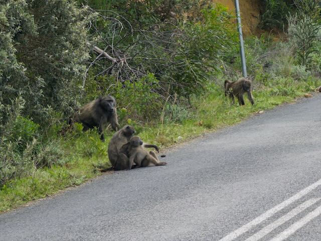
We slow when we see the road filled with baboons. They're just looking for food (in your car or where ever). Signs warn you not to open your windows. There are park rangers with paintball guns roaming around to "coax" the primates back up off the road (in a non-leathal fashion).

Simon's Town, where we had lunch. Cute enough.

Speaking of cute, African Penguins! Like weather vanes they all face into the wind, it seems.
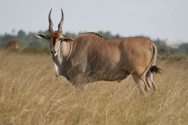
Not quite as handsome, the eland, a type of antelope, looks like an impala who had too many steroids. You may know this animal as a taurotragus oryx.

Bo Kaap, the part of Cape Town with too fun colored houses. The slaves, no long slaves and no longer beholden to the white man's rules, paint the houses fun colors because they can and it makes them happy. It makes us happy.

After dinner we see that Table Mountain is lit up at night. Who knew?


Comments